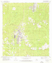
1974 Map of Fort Polk
USGS Topo · Published 1976About this map
Fort Polk Military Reservation dominates this 1970s landscape, illustrating the footprint of a major Army installation within the timberlands of the Kisatchie National Forest. The map documents the extensive built environment of Fort Polk and North Fort Polk, including hospital complexes, residential trailer parks, and an intricate network of range towers such as Forsythe Tower and McClellen Tower. Beyond the military infrastructure, the terrain is defined by the winding waters of Whisky Chitto Creek and Bundick Creek. Traces of earlier Vernon Parish history remain visible through several numbered and named burial grounds, including Smart Cem and Zion Hill Cem, while the Kansas City Southern Railroad cuts across the western edge. This survey captures a moment when the transition between active military training zones and the surrounding rural parishes was clearly delineated by features like the Pine Island Ch.
Find a feature on this map
55 named features on this map. Tap any name to fly to it.
Don’t see what you’re looking for? This feature index may not catch every label — zoom into the map to look around manually.
Map Details
Editions of this 1974 Fort Polk Map
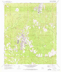
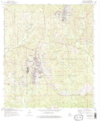
3 editions found
Other maps of this area

1941 · Leesville
USGS Topo · 1:62,500

1941 · Slagle
USGS Topo · 1:62,500

1943 · Leesville
USGS Topo · 1:62,500

1944 · Slagle
USGS Topo · 1:62,500

1946 · Leesville
USGS Topo · 1:62,500

1947 · Rosepine
USGS Topo · 1:31,680

1947 · Chasmore
USGS Topo · 1:31,680

1947 · Sugrue
USGS Topo · 1:31,680

1948 · Leesville
USGS Topo · 1:62,500

1952 · Lake Charles
USGS Topo · 1:250,000
Featured Places
- Fort Polk, Fort Johnson South
- Sandy Hill, LA
- North Fort Polk, LA
- Fort Johnson South, LA
- Vernon Parish, LA