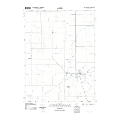
2010 Map of Fort Recovery
USGS Topo · Published 2010About this map
Fort Recovery serves as the focal point of this borderland survey, situated where the Wabash River meanders across the Ohio Indiana State Line Rd. The landscape is defined by a dense grid of rural roads and drainage networks, including Wilson Creek, Limberlost Creek, and the Salamonie River in the southwestern corner near Salamonia. A significant number of local burial sites, such as the Old Pioneer Cemetery, Green Mound Cemetery, and Saint Mary Cemetery, are clustered near the town center, providing a clear geographic record of the area's long-established community roots.
Find a feature on this map
74 named features on this map. Tap any name to fly to it.
Don’t see what you’re looking for? This feature index may not catch every label — zoom into the map to look around manually.
Map Details
Editions of this 2010 Fort Recovery Map
This is the sole edition of this map. No revisions or reprints were ever made.
Other maps of this area

1908 · St. Henry
USGS Topo · 1:62,500

1911 · Berne
USGS Topo · 1:48,000

1914 · Celina
USGS Topo · 1:62,500

1915 · Fort Recovery
USGS Topo · 1:48,000

1918 · Fort Recovery
USGS Topo · 1:62,500

1944 · Celina
USGS Topo · 1:62,500

1953 · Muncie
USGS Topo · 1:250,000

1956 · Muncie
USGS Topo · 1:250,000

1960 · Fort Recovery
USGS Topo · 1:24,000
1960 · Erastus
USGS Topo · 1:24,000