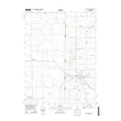
2013 Map of Fort Recovery
USGS Topo · Published 2013About this map
Fort Recovery serves as the focal point of this borderland survey, where the Indiana Ohio state line divides the agricultural landscape of Jay and Mercer counties. The town's historical roots are visible in its concentrated collection of burial grounds, including the Old Pioneer Cem, Green Mound Cem, and Saint Mary Cem. This area marks the headwaters of significant drainage systems, with the Wabash River flowing through the center while the Salamonie River emerges to the southwest near Salamonia.
Find a feature on this map
108 named features on this map. Tap any name to fly to it.
Don’t see what you’re looking for? This feature index may not catch every label — zoom into the map to look around manually.
Map Details
Editions of this 2013 Fort Recovery Map
This is the sole edition of this map. No revisions or reprints were ever made.
Other maps of this area

1908 · St. Henry
USGS Topo · 1:62,500

1911 · Berne
USGS Topo · 1:48,000

1914 · Celina
USGS Topo · 1:62,500

1915 · Fort Recovery
USGS Topo · 1:48,000

1918 · Fort Recovery
USGS Topo · 1:62,500

1944 · Celina
USGS Topo · 1:62,500

1953 · Muncie
USGS Topo · 1:250,000

1956 · Muncie
USGS Topo · 1:250,000

1960 · Fort Recovery
USGS Topo · 1:24,000
1960 · Erastus
USGS Topo · 1:24,000