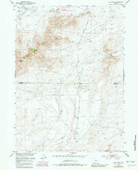
1951 Map of Fort Ridge
USGS Topo · Published 1981About this map
The Emigrant Trail traces a historic passage across this high-desert landscape, following the northern corridor of the Sweetwater River. This 1951 survey, with 1980 revisions, reveals the intersection of pioneer history and mid-century land management within the Pathfinder National Wildlife Refuge. The terrain is defined by the prominent elevation of Fort Ridge and a network of drainage features like Arkansas Creek, which flow through the transition between Natrona and Carbon Counties. While the river corridor served early transcontinental travelers, later infrastructure is evident through the development of the Pipe Line, Buzzard Road, and industrial markers such as Station 8. These layers of transit—from the wagon-worn ruts of the 19th century to the energy infrastructure of the 20th—illustrate the enduring role of this region as a critical transit artery through the Wyoming interior.
Find a feature on this map
13 named features on this map. Tap any name to fly to it.
Don’t see what you’re looking for? This feature index may not catch every label — zoom into the map to look around manually.
Map Details
Editions of this 1951 Fort Ridge Map
3 editions found
Other maps of this area

1951 · Benton Basin SW
USGS Topo · 1:24,000

1951 · Pathfinder Reservoir NW
USGS Topo · 1:24,000

1951 · Independence Rock
USGS Topo · 1:24,000

1951 · Fort Ridge
USGS Topo · 1:24,000

1953 · Pathfinder Reservoir SW
USGS Topo · 1:24,000

1953 · Buzzard Ranch
USGS Topo · 1:24,000

1953 · Spanish Mine
USGS Topo · 1:24,000

1955 · Casper
USGS Topo · 1:250,000

1958 · Casper
USGS Topo · 1:250,000

1959 · Sanford Ranch
USGS Topo · 1:24,000