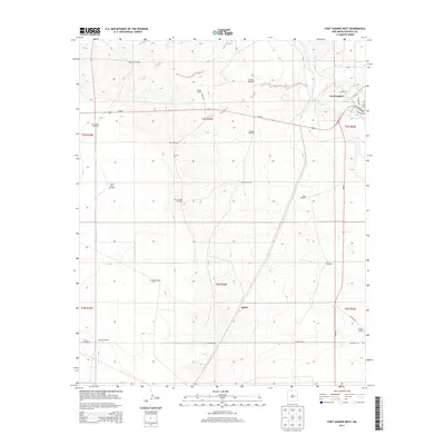
2013 Map of Fort Sumner West
USGS Topo · Published 2013About this map
Fort Sumner serves as the focal point of this De Baca County landscape, where the Pecos River and its accompanying Fort Sumner Main Canal define the eastern edge of the survey. The terrain transitions from the river valley into an arid ranching environment to the west, marked by a systematic network of family-named windmills and ranches. Agudo and the Vaughn Ranch are prominent in the southeast, while the northern reaches feature the Steele Ranch and Martinez Windmill. The map documents a classic Southwestern infrastructure of water management and livestock movement, traced through numerous landmarks like the New Eclipse Windmill and Bays Windmill. Connectivity is maintained via Us-60 E cutting across the northern half and the intersection of NM-20 and Ricardo Rd in the south, illustrating the spatial distribution of remote homesteads and critical water sources in the High Plains.
Find a feature on this map
37 named features on this map. Tap any name to fly to it.
Don’t see what you’re looking for? This feature index may not catch every label — zoom into the map to look around manually.
Map Details
Editions of this 2013 Fort Sumner West Map
This is the sole edition of this map. No revisions or reprints were ever made.
Other maps of this area

1954 · Fort Sumner
USGS Topo · 1:250,000

1958 · Fort Sumner
USGS Topo · 1:250,000

1965 · Fort Sumner West
USGS Topo · 1:24,000

1965 · Windmill Draw
USGS Topo · 1:24,000

1966 · West Camp
USGS Topo · 1:24,000

1966 · Alamo Ranch
USGS Topo · 1:24,000

1966 · Ricardo
USGS Topo · 1:24,000

1966 · Alamogordo Dam
USGS Topo · 1:24,000

1968 · Fort Sumner East
USGS Topo · 1:24,000

1968 · Bonner Lake
USGS Topo · 1:24,000