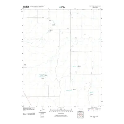
2010 Map of Fort Supply NE
USGS Topo · Published 2010About this map
Sand Creek meanders through this portion of Harper County, carving a subtle drainage pattern through the Oklahoma landscape. The terrain is defined by a strictly organized grid of rural roads, including e0200 RD and n1940 RD, which facilitate movement between scattered agricultural holdings. A primary landmark for local historians and genealogists is Kibby Cemetery, situated in the northern reaches of the quadrangle. The area's water management is notably intensive, evidenced by numerous small-scale reservoirs and dams such as the Oknoname 05929 Reservoir and the Oknoname 05930 Reservoir. These features, alongside named structures like Randall 2 Dam and Owens 2 Dam, suggest a landscape where water capture is essential for sustaining the region's ranching or farming operations.
Find a feature on this map
31 named features on this map. Tap any name to fly to it.
Don’t see what you’re looking for? This feature index may not catch every label — zoom into the map to look around manually.
Map Details
Editions of this 2010 Fort Supply NE Map
This is the sole edition of this map. No revisions or reprints were ever made.
Other maps of this area

1955 · Woodward
USGS Topo · 1:250,000

1958 · Woodward
USGS Topo · 1:250,000

1970 · Buffalo SE
USGS Topo · 1:24,000

1970 · Sleeping Bear Creek SW
USGS Topo · 1:24,000

1970 · Sleeping Bear Creek NW
USGS Topo · 1:24,000

1970 · Buffalo
USGS Topo · 1:24,000

1971 · May East
USGS Topo · 1:24,000

1971 · Fort Supply
USGS Topo · 1:24,000

1971 · Fort Supply NW
USGS Topo · 1:24,000

1971 · Selman
USGS Topo · 1:24,000