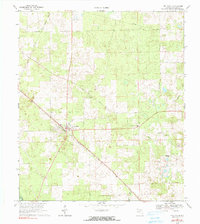
1969 Map of Fort White
USGS Topo · Published 1990About this map
Fort White serves as the central hub of this North Florida landscape, where the Seaboard Coast Line railroad cuts diagonally through the terrain. The community is defined by a network of traditional rural corridors like Bellamy Road and Herlong Road, connecting scattered homesteads and small agricultural plots. Notable local landmarks include the Fort White-Bethlehem Sch and several country churches that anchored the area's social life, such as Elim Ch and Tustenuggee Ch.
Find a feature on this map
21 named features on this map. Tap any name to fly to it.
Don’t see what you’re looking for? This feature index may not catch every label — zoom into the map to look around manually.
Map Details
Editions of this 1969 Fort White Map
3 editions found
Other maps of this area

1954 · Gainesville
USGS Topo · 1:250,000

1954 · Valdosta
USGS Topo · 1:250,000

1958 · Valdosta
USGS Topo · 1:250,000

1958 · Gainesville
USGS Topo · 1:250,000

1959 · Valdosta
USGS Topo · 1:250,000

1959 · Gainesville
USGS Topo · 1:250,000

1962 · High Springs
USGS Topo · 1:24,000

1962 · Mikesville
USGS Topo · 1:24,000

1963 · Ellisville
USGS Topo · 1:24,000

1963 · Columbia
USGS Topo · 1:24,000