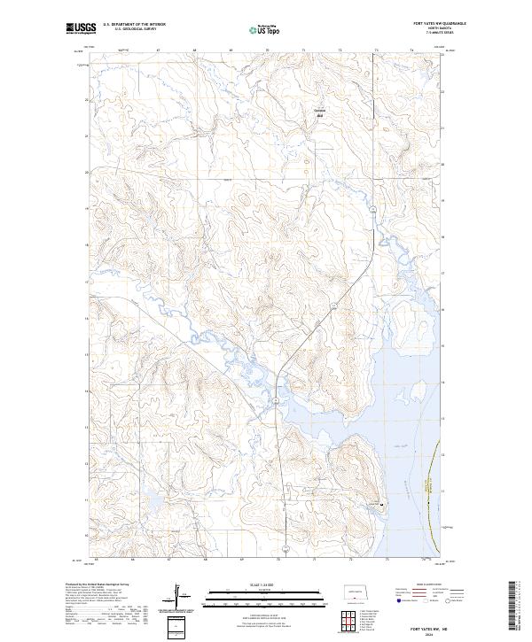
2024 Map of Fort Yates NW
USGS Topo · Published 2024About this map
Cannon Ball anchors this riverine landscape where the high plains meet the vast waters of Lake Oahe. The map depicts the confluence and surrounding drainage systems of the Missouri River in southern North Dakota, revealing a rugged topography carved by numerous waterways including Stone Man Creek, Battle Creek, and Porcupine Creek. These creek beds create deep draws and ridges across the Standing Rock Reservation area, where local infrastructure is represented by routes like BIA Rte 6 and BIA Rd 8. Cultural and genealogical points of interest are highlighted by Saint Lukes Cem, situated near the shoreline. The transition from established riverbanks to the modern flooded basin of the reservoir reflects the twentieth-century transformation of the Missouri Valley, maintaining clear township and range boundaries such as t132n r80w and t131n r80w across the varying elevations.
Find a feature on this map
16 named features on this map. Tap any name to fly to it.
Don’t see what you’re looking for? This feature index may not catch every label — zoom into the map to look around manually.
Map Details
Editions of this 2024 Fort Yates NW Map
This is the sole edition of this map. No revisions or reprints were ever made.
Other maps of this area

1954 · Bismarck
USGS Topo · 1:250,000

1958 · Bismarck
USGS Topo · 1:250,000

1968 · Cannon Ball SE
USGS Topo · 1:24,000

1968 · Fort Yates NW
USGS Topo · 1:24,000

1968 · Fort Yates SE
USGS Topo · 1:24,000

1968 · Fort Yates
USGS Topo · 1:24,000

1968 · Fort Yates NE
USGS Topo · 1:24,000

1968 · Cannon Ball SW
USGS Topo · 1:24,000

1971 · Barren Butte
USGS Topo · 1:24,000

1971 · Half Timber Butte
USGS Topo · 1:24,000