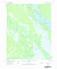
1966 Map of Fort Yukon A-2
USGS Topo · Published 1984About this map
The Yukon River dominates the northeastern portion of this interior Alaska landscape, characterized by an intricate network of sloughs and side channels. Navigational points like Halfway Whirlpool and Saloon Island indicate the importance of river travel through this remote subarctic region. South of the main river, the land becomes a complex wetland environment where the meandering Birch Creek meets its tributaries, including Preacher Creek and Little Preacher Creek. This 1950s-era topography, based on aerial photography, shows an unpopulated wilderness defined by water and low relief. Scattered across the alluvial plain are numerous small bodies of water such as Cosstrail Lake and the Geese Lakes, highlighting a landscape that remains largely unsurveyed and unmarked by permanent settlements or roads.
Find a feature on this map
8 named features on this map. Tap any name to fly to it.
Don’t see what you’re looking for? This feature index may not catch every label — zoom into the map to look around manually.
Map Details
Editions of this 1966 Fort Yukon A-2 Map
This is the sole edition of this map. No revisions or reprints were ever made.
Other maps of this area

1951 · Fort Yukon
USGS Topo · 1:250,000

1951 · Circle
USGS Topo · 1:250,000

1952 · Circle D-3
USGS Topo · 1:63,360

1952 · Circle D-2
USGS Topo · 1:63,360

1955 · Circle D-1
USGS Topo · 1:63,360

1955 · Circle
USGS Topo · 1:250,000

1956 · Fort Yukon A-2
USGS Topo · 1:63,360

1956 · Fort Yukon B-3
USGS Topo · 1:63,360

1956 · Fort Yukon B-1
USGS Topo · 1:63,360

1956 · Fort Yukon A-1
USGS Topo · 1:63,360