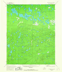
1966 Map of Fort Yukon A-4
USGS Topo · Published 1967About this map
Mouth Birch Creek marks the transition between the low-lying wetlands and the rising highlands in this interior Alaskan wilderness. Surveyed in the early 1950s with minor revisions in the mid-1960s, the landscape is defined by a dense concentration of water bodies. Large, prominent features such as Twin Island Lake and Three Lakes dominate the northern flats, while the southern portion of the map rises into significant elevation points like Vabm 798 Small. The drainage pattern is led by Discovery Creek and Lower Chloya Lake, reflecting an area largely untouched by permanent settlement or road infrastructure during this era. This survey, interpreted from aerial photography by the Bureau of Land Management and the U.S. Geological Survey, provides a precise look at the hydrology of the Yukon-Koyukuk region before contemporary changes.
Find a feature on this map
7 named features on this map. Tap any name to fly to it.
Don’t see what you’re looking for? This feature index may not catch every label — zoom into the map to look around manually.
Map Details
Editions of this 1966 Fort Yukon A-4 Map
This is the sole edition of this map. No revisions or reprints were ever made.
Other maps of this area

1951 · Fort Yukon
USGS Topo · 1:250,000

1951 · Circle
USGS Topo · 1:250,000

1952 · Circle D-4
USGS Topo · 1:63,360

1952 · Circle D-3
USGS Topo · 1:63,360

1952 · Circle D-5
USGS Topo · 1:63,360

1954 · Circle D-5
USGS Topo · 1:63,360

1955 · Circle
USGS Topo · 1:250,000

1956 · Fort Yukon B-4
USGS Topo · 1:63,360

1956 · Fort Yukon A-4
USGS Topo · 1:63,360

1956 · Fort Yukon B-3
USGS Topo · 1:63,360