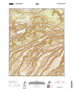
2018 Map of Fort Yukon A-6 SW
USGS Topo · Published 2018About this map
Shoeheel Lake and Gas Lake sit amidst a complex network of wetlands and minor drainages in this remote section of the Yukon-Koyukuk region. The landscape is defined by the hydrologic patterns of the Flat Creek system, including the W Fork Flat Cr, E Fork Flat Cr, and the main stem of Flat Cr itself. These waterways wind through terrain marked by numerous small basins and glacial features, such as Lower Halfway Lake and Upper Halfway Lake. The absence of established roads or settlements in this 2018 survey emphasizes the undisturbed nature of this subarctic wilderness, where the geography is shaped almost entirely by seasonal water flow and the underlying permafrost-influenced topography. For researchers, the map provides a precise record of water levels and drainage paths as they existed in the early 21st century.
Find a feature on this map
12 named features on this map. Tap any name to fly to it.
Don’t see what you’re looking for? This feature index may not catch every label — zoom into the map to look around manually.
Map Details
Editions of this 2018 Fort Yukon A-6 SW Map
This is the sole edition of this map. No revisions or reprints were ever made.
Other maps of this area

1945 · Livengood
USGS Topo · 1:250,000

1951 · Fort Yukon
USGS Topo · 1:250,000

1951 · Livengood
USGS Topo · 1:250,000

1951 · Beaver
USGS Topo · 1:250,000

1951 · Circle
USGS Topo · 1:250,000

1951 · Circle D-6
USGS Topo · 1:63,360

1952 · Livengood D-1
USGS Topo · 1:63,360

1954 · Circle D-6
USGS Topo · 1:63,360
1954 · Livengood D-1
USGS Topo · 1:63,360

1955 · Circle
USGS Topo · 1:250,000