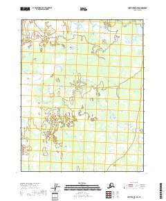
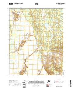
2018 Map of Fort Yukon B-1 SW
USGS Topo · Published 2018About this map
The interior of the Yukon-Koyukuk Census Area reveals a vast, water-heavy landscape dominated by a network of wetlands and seasonal water bodies. This 2018 survey emphasizes the hydraulic character of the region, where the terrain is segmented by the Public Land Survey System grids including T18n R15e, T18n R16e, T17n R15e, and T17n R16e. The absence of named settlements or roads highlights the isolation and untouched state of these northern lowlands, where topographical variations are subtle and dictated by the movement of water across the flats. Genealogists or researchers tracking historical land divisions will find the precise township and range boundaries essential for identifying specific tracts within this remote Alaskan wilderness.
Find a feature on this map
4 named features on this map. Tap any name to fly to it.
Don’t see what you’re looking for? This feature index may not catch every label — zoom into the map to look around manually.
Map Details
Editions of this 2018 Fort Yukon B-1 SW Map
This is the sole edition of this map. No revisions or reprints were ever made.
Other maps of this area

1951 · Fort Yukon
USGS Topo · 1:250,000

1956 · Fort Yukon A-2
USGS Topo · 1:63,360

1956 · Fort Yukon B-1
USGS Topo · 1:63,360

1956 · Fort Yukon A-1
USGS Topo · 1:63,360

1956 · Fort Yukon B-2
USGS Topo · 1:63,360

1956 · Fort Yukon
USGS Topo · 1:250,000
1966 · Fort Yukon A-2
USGS Topo · 1:63,360
2018 · Fort Yukon B-2 SE
USGS Topo · 1:25,000
2018 · Fort Yukon B-1 NW
USGS Topo · 1:25,000
2018 · Fort Yukon A-1 NE
USGS Topo · 1:25,000