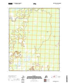
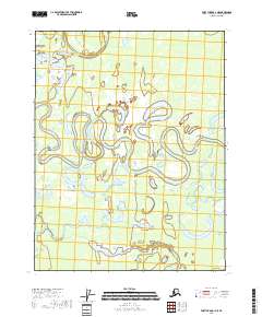
2018 Map of Fort Yukon C-1 SW
USGS Topo · Published 2018About this map
John Kwillik Slough meanders through the northern reaches of this interior Alaskan landscape within the Yukon-Koyukuk Census Area. The terrain is characterized by a complex network of wetlands and seasonal water bodies typical of the Yukon Flats region, as documented by the U.S. Geological Survey in 2018. This particular area is defined primarily by its hydrological patterns rather than human infrastructure, with the Public Land Survey System grid lines for t21n r15e, t21n r16e, and southern townships providing the only formal organizational framework. The presence of numerous unnamed ponds and drainage channels indicates a dynamic, shifting environment where water levels fluctuate across the flat alluvial plain.
Find a feature on this map
7 named features on this map. Tap any name to fly to it.
Don’t see what you’re looking for? This feature index may not catch every label — zoom into the map to look around manually.
Map Details
Editions of this 2018 Fort Yukon C-1 SW Map
This is the sole edition of this map. No revisions or reprints were ever made.
Other maps of this area

1951 · Fort Yukon
USGS Topo · 1:250,000

1952 · Fort Yukon C-2
USGS Topo · 1:63,360

1956 · Fort Yukon C-1
USGS Topo · 1:63,360

1956 · Fort Yukon B-1
USGS Topo · 1:63,360

1956 · Fort Yukon B-2
USGS Topo · 1:63,360

1956 · Fort Yukon
USGS Topo · 1:250,000
1956 · Fort Yukon C-2
USGS Topo · 1:63,360
2018 · Fort Yukon B-1 NW
USGS Topo · 1:25,000
2018 · Fort Yukon C-2 NE
USGS Topo · 1:25,000
2018 · Fort Yukon C-1 NE
USGS Topo · 1:25,000