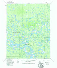
1955 Map of Fort Yukon C-3
USGS Topo · Published 1995About this map
Fort Yukon sits at the critical confluence of the Yukon River and the Porcupine River, serving as a vital hub in the vast northern interior. The settlement is anchored by the Fort Yukon Municipal Airport and a Seaplane Base on Hospital Lake, illustrating the mid-century dependence on bush aviation for mail and transport. The surrounding Yukon Flats comprise a labyrinthine network of water, including Nuntragut Slough, Eightmile Slough, and Yilota Slough, which define a landscape of shifting channels and silt-laden banks. A Winter Trail provides the only overland connection shown, winding past Toussaint Island toward the south. This environment is further characterized by numerous named islands like Homebrew Island and Jenny Island, and small backcountry camps labeled simply as Cabin, reflecting the subsistence and seasonal patterns of life within the Yukon Flats National Wildlife Refuge.
Find a feature on this map
31 named features on this map. Tap any name to fly to it.
Don’t see what you’re looking for? This feature index may not catch every label — zoom into the map to look around manually.
Map Details
Editions of this 1955 Fort Yukon C-3 Map
3 editions found
Other maps of this area

1951 · Fort Yukon
USGS Topo · 1:250,000

1952 · Fort Yukon C-2
USGS Topo · 1:63,360

1952 · Fort Yukon C-3
USGS Topo · 1:63,360

1952 · Fort Yukon C-4
USGS Topo · 1:63,360

1955 · Fort Yukon D-2
USGS Topo · 1:63,360

1955 · Fort Yukon D-3
USGS Topo · 1:63,360

1955 · Fort Yukon D-4
USGS Topo · 1:63,360

1955 · Fort Yukon C-3
USGS Topo · 1:63,360

1956 · Fort Yukon B-4
USGS Topo · 1:63,360

1956 · Fort Yukon B-3
USGS Topo · 1:63,360