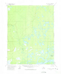
1956 Map of Fort Yukon C-6
USGS Topo · Published 1974About this map
The Yukon River dominates the southern landscape of this mid-century survey, defining a vast riparian environment where the Hadweenzic River winds through an intricate network of wetlands and small lakes. This area of the Alaskan interior remains largely unsettled in the 1950s, with topographic data revealing a terrain dominated by hydrologic patterns rather than human infrastructure. A lone Cabin situated near the south-central portion of the map provides a rare indicator of human presence or seasonal activity in this wilderness. The presence of Deadman Island within the wide channel of the Yukon highlights the dynamic nature of the river's course and the shifting alluvial features that characterize this reach of the river system north of the Arctic Circle.
Find a feature on this map
4 named features on this map. Tap any name to fly to it.
Don’t see what you’re looking for? This feature index may not catch every label — zoom into the map to look around manually.
Map Details
Editions of this 1956 Fort Yukon C-6 Map
2 editions found
Other maps of this area

1951 · Fort Yukon
USGS Topo · 1:250,000

1951 · Beaver
USGS Topo · 1:250,000

1955 · Fort Yukon D-5
USGS Topo · 1:63,360

1955 · Fort Yukon C-5
USGS Topo · 1:63,360

1956 · Fort Yukon B-6
USGS Topo · 1:63,360

1956 · Beaver
USGS Topo · 1:250,000

1956 · Fort Yukon C-5
USGS Topo · 1:63,360

1956 · Beaver B-1
USGS Topo · 1:63,360

1956 · Fort Yukon B-5
USGS Topo · 1:63,360

1956 · Fort Yukon
USGS Topo · 1:250,000