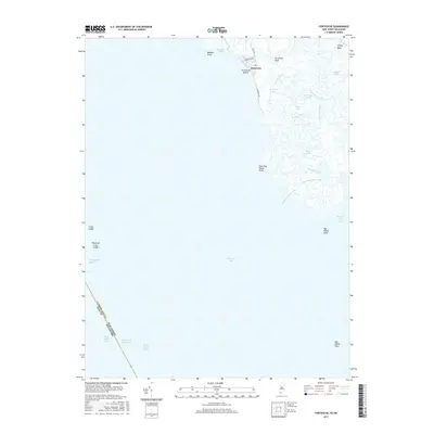
2017 Map of Fortescue
USGS Topo · Published 2017About this map
Fortescue sits at the edge of the Delaware Bay, serving as a coastal anchor for this wetland-dominated landscape in Cumberland County. The map details a complex hydraulic network where Oranoaken Creek and Fishing Creek snake through the salt marshes toward the Maurice River Cove. This area is characterized by shifting shorelines and maritime navigational aids, including the Intracoastal Waterway and various ranges such as the Miah Maull Range and Main Maull Range. Significant geographic markers like False Egg Island Point and Egg Island Point define the southern reaches, while the small street grid of the village, including Louisiana Ave and Delaware Ave, provides a stark contrast to the surrounding tidal flats and drainage ditches like Pierson Ditch.
Find a feature on this map
36 named features on this map. Tap any name to fly to it.
Don’t see what you’re looking for? This feature index may not catch every label — zoom into the map to look around manually.
Map Details
Editions of this 2017 Fortescue Map
This is the sole edition of this map. No revisions or reprints were ever made.
Other maps of this area

1890 · Maurice Cove
USGS Topo · 1:62,500

1890 · Bay Side
USGS Topo · 1:62,500

1890 · Bridgeton
USGS Topo · 1:62,500

1891 · Maurice Cove
USGS Topo · 1:62,500

1894 · Bay Side
USGS Topo · 1:62,500

1894 · Bridgeton
USGS Topo · 1:62,500

1899 · Vineland
USGS Topo · 1:125,000

1919 · Vineland
USGS Topo · 1:125,000
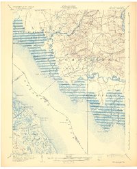
1931 · Bay Side
USGS Topo · 1:62,500

1934 · Bowers
USGS Topo · 1:48,000
Featured Places
- Downe Township, NJ
- Fortescue, Downe Township
- Raybins Beach, Downe Township
- Kent County, DE
- Cumberland County, NJ