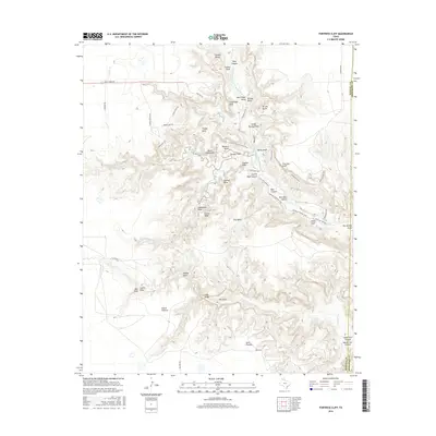
2016 Map of Fortress Cliff
USGS Topo · Published 2016About this map
Palo Duro Canyon dominates this landscape, where the Prairie Dog Town Fork Red River has carved a massive system of plateaus and spires through Randall and Armstrong counties. The canyon floor and rim are defined by geological landmarks such as Lighthouse Peak, Goodnight Peak, and the sheer rise of Fortress Cliff. The intricate trail network, including the Comanche Trail and the Givens, Spicer & Lowry Trail, reveals a geography of deep draws and isolated mesas like Timber Mesa and Red Mesa. Notable features such as Judys Arch and Devils Tombstone offer specific points of interest for researchers tracking the physical history of this terrain. This survey provides a meticulous record of the canyon's verticality, from the high Elbow Plateau down to the seasonal flows of Sunday Creek and Little Sunday Creek.
Find a feature on this map
63 named features on this map. Tap any name to fly to it.
Don’t see what you’re looking for? This feature index may not catch every label — zoom into the map to look around manually.
Map Details
Editions of this 2016 Fortress Cliff Map
This is the sole edition of this map. No revisions or reprints were ever made.
Other maps of this area

1954 · Amarillo
USGS Topo · 1:250,000

1954 · Plainview
USGS Topo · 1:250,000

1956 · Fortress Cliff
USGS Topo · 1:24,000

1956 · Thomas Ranch
USGS Topo · 1:24,000

1958 · Amarillo
USGS Topo · 1:250,000

1958 · Plainview
USGS Topo · 1:250,000

1960 · Canyon
USGS Topo · 1:62,500

1960 · Fairview
USGS Topo · 1:24,000

1960 · The Palisades
USGS Topo · 1:24,000

1960 · Wayside
USGS Topo · 1:62,500