
1960 Map of The Palisades
USGS Topo · Published 1961About this map
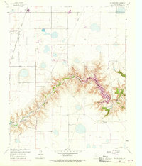
Palo Duro Canyon carves a dramatic path through the High Plains south of Amarillo, dominated by the erosion of the Prairie Dog Town Fork Red River. This 1960 survey illustrates the striking contrast between the flat upland agricultural tablelands and the deeply dissected canyon floor. Along the rim and within the breaks, the map identifies landmarks such as The Palisades and Devils Kitchen, while the river's winding course is dotted with water features like Palo Duro Club Lake and Currie Lake.
Find a feature on this map
15 named features on this map. Tap any name to fly to it.
Don’t see what you’re looking for? This feature index may not catch every label — zoom into the map to look around manually.
Map Details
Editions of this 1960 The Palisades Map
3 editions found
Other maps of this area

1954 · Amarillo
USGS Topo · 1:250,000

1954 · Plainview
USGS Topo · 1:250,000

1956 · Fortress Cliff
USGS Topo · 1:24,000

1956 · Amarillo East
USGS Topo · 1:24,000

1956 · Thomas Ranch
USGS Topo · 1:24,000

1956 · Pullman
USGS Topo · 1:24,000

1958 · Amarillo
USGS Topo · 1:250,000

1958 · Plainview
USGS Topo · 1:250,000

1960 · Canyon
USGS Topo · 1:62,500
1960 · Amarillo West
USGS Topo · 1:24,000