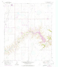
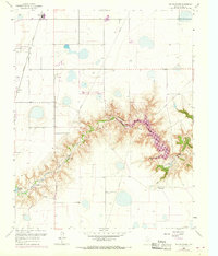
1960 Map of The Palisades
USGS Topo · Published 1975About this map
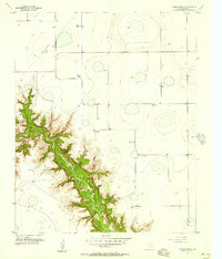
Palo Duro Canyon dominates this landscape, where the Prairie Dog Town Fork Red River carves through the Texas Panhandle. This mid-century survey illustrates the era's recreation and water management, highlighting the development of Lake Tanglewood and the smaller Palo Duro Club Lake. The presence of Camp Harrington along the river fork suggests the area's importance for local youth organizations during the 1950s and 60s.
Find a feature on this map
18 named features on this map. Tap any name to fly to it.
Don’t see what you’re looking for? This feature index may not catch every label — zoom into the map to look around manually.
Map Details
Editions of this 1960 The Palisades Map
3 editions found
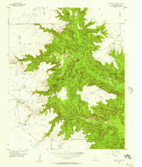
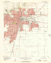
Other maps of this area

1954 · Amarillo
USGS Topo · 1:250,000

1954 · Plainview
USGS Topo · 1:250,000
1956 · Fortress Cliff
USGS Topo · 1:24,000
1956 · Amarillo East
USGS Topo · 1:24,000
1956 · Thomas Ranch
USGS Topo · 1:24,000
1956 · Pullman
USGS Topo · 1:24,000

1958 · Amarillo
USGS Topo · 1:250,000

1958 · Plainview
USGS Topo · 1:250,000
1960 · Canyon
USGS Topo · 1:62,500
1960 · The Palisades
USGS Topo · 1:24,000