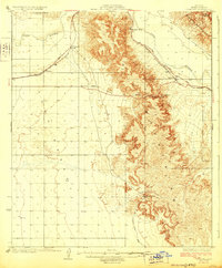
1929 Map of Fortuna
USGS Topo · Published 1929About this map
Gila River waters carve through this arid landscape, defining the northern corridor where the Yuma Southern Pacific Gila Bend Road connects isolated desert stations. This 1929 edition, overseen by Governor Geo. W. P. Hunt, details the transit-driven development of the Gila Valley, where rail stops like Blaisdell and Ligurta served as vital links between the Laguna Mts and the towering heights of the Muggins Mountains.
Find a feature on this map
17 named features on this map. Tap any name to fly to it.
Don’t see what you’re looking for? This feature index may not catch every label — zoom into the map to look around manually.
Map Details
Editions of this 1929 Fortuna Map
4 editions found
Other maps of this area

1903 · Yuma
USGS Topo · 1:125,000

1905 · Yuma
USGS Topo · 1:125,000

1926 · Fortuna
USGS Topo · 1:62,500

1926 · Wellton
USGS Topo · 1:62,500

1929 · Fortuna
USGS Topo · 1:62,500

1929 · Laguna
USGS Topo · 1:62,500

1929 · Wellton
USGS Topo · 1:62,500

1940 · Yuma
USGS Topo · 1:62,500

1942 · Yuma
USGS Topo · 1:250,000

1943 · Laguna
USGS Topo · 1:62,500