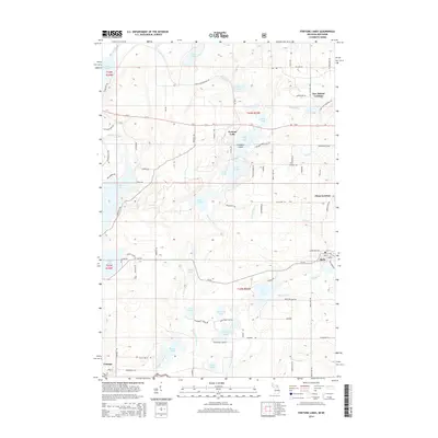
2014 Map of Fortune Lakes
USGS Topo · Published 2014About this map
Fortune Lakes and the adjacent waters of Chicagon Lake dominate this Upper Peninsula landscape, where the Michigan and Wisconsin border meets near the Brule River. The settlement of Alpha serves as a primary hub in the eastern portion of the map, while Pentoga and the New Bristol Location reflect the region's legacy of organized settlement and resource extraction. Evidence of the area's industrial past is visible in the presence of Chicagon Mine Rd, which once served local mineral interests.
Find a feature on this map
92 named features on this map. Tap any name to fly to it.
Don’t see what you’re looking for? This feature index may not catch every label — zoom into the map to look around manually.
Map Details
Editions of this 2014 Fortune Lakes Map
This is the sole edition of this map. No revisions or reprints were ever made.
Other maps of this area

1898 · Iron River
USGS Topo · 1:62,500

1899 · Crystal Falls
USGS Topo · 1:62,500

1939 · Long Lake
USGS Topo · 1:48,000

1941 · Florence
USGS Topo · 1:48,000

1944 · Crystal Falls
USGS Topo · 1:24,000

1944 · Gaastra
USGS Topo · 1:24,000

1944 · Fortune Lakes
USGS Topo · 1:24,000

1945 · Sunset Lake
USGS Topo · 1:24,000

1945 · Kelso Junction
USGS Topo · 1:24,000

1945 · Amasa
USGS Topo · 1:24,000