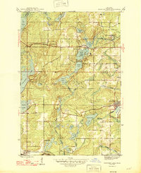
1946 Map of Fortune Lakes
USGS Topo · Published 1946About this map
Alpha and the surrounding Iron County woodlands define this mid-century landscape, characterized by a complex network of glacial lakes and industrial rail spurs. The Chicago and Northwestern and the Milwaukee St Paul and Pacific railroads intersect near the eastern edge, serving mining outposts like New Bristol Location and Dunn Location. These "locations" represent the clustered housing typical of Upper Peninsula mining communities of the era.
Find a feature on this map
34 named features on this map. Tap any name to fly to it.
Don’t see what you’re looking for? This feature index may not catch every label — zoom into the map to look around manually.
Map Details
Editions of this 1946 Fortune Lakes Map
2 editions found

Other maps of this area

1898 · Iron River
USGS Topo · 1:62,500

1899 · Crystal Falls
USGS Topo · 1:62,500

1939 · Long Lake
USGS Topo · 1:48,000

1941 · Florence
USGS Topo · 1:48,000

1944 · Crystal Falls
USGS Topo · 1:24,000

1944 · Gaastra
USGS Topo · 1:24,000

1944 · Fortune Lakes
USGS Topo · 1:24,000

1945 · Sunset Lake
USGS Topo · 1:24,000

1945 · Kelso Junction
USGS Topo · 1:24,000

1945 · Amasa
USGS Topo · 1:24,000