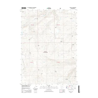
2015 Map of Fossil Hill
USGS Topo · Published 2015About this map
Shoshone National Forest contains a complex network of drainages and high-altitude terrain in this 2015 study south of Lander. The hydrography is particularly distinctive, featuring The Sinks along the Middle Popo Agie River, where the waterway disappears into the limestone before re-emerging downstream in Sinks Canyon. The landscape is defined by massive natural elevations such as Fossil Hill and Bayer Mtn, alongside structural features like the Walker Ditch and access routes including Sinks Canyon Rd and Louis Lake Rd. Geologic interest is found in the deep cuts of Little Popo Agie Canyon and the surrounding peaks like Young Mtn and the Freak Mountains. This map documents a wilderness interface where water management and recreation meet the steep slopes of Indian Ridge and Blue Ridge.
Find a feature on this map
44 named features on this map. Tap any name to fly to it.
Don’t see what you’re looking for? This feature index may not catch every label — zoom into the map to look around manually.
Map Details
Editions of this 2015 Fossil Hill Map
This is the sole edition of this map. No revisions or reprints were ever made.
Other maps of this area

1952 · Lander
USGS Topo · 1:24,000

1953 · Cony Mountain
USGS Topo · 1:24,000

1953 · Mount Arter
USGS Topo · 1:24,000

1953 · Fossil Hill
USGS Topo · 1:24,000

1953 · Louis Lake
USGS Topo · 1:24,000

1953 · Christina Lake
USGS Topo · 1:24,000

1953 · Mount Arter SE
USGS Topo · 1:24,000

1954 · Wolf Point
USGS Topo · 1:24,000

1954 · Miners Delight
USGS Topo · 1:24,000

1955 · Lander
USGS Topo · 1:250,000