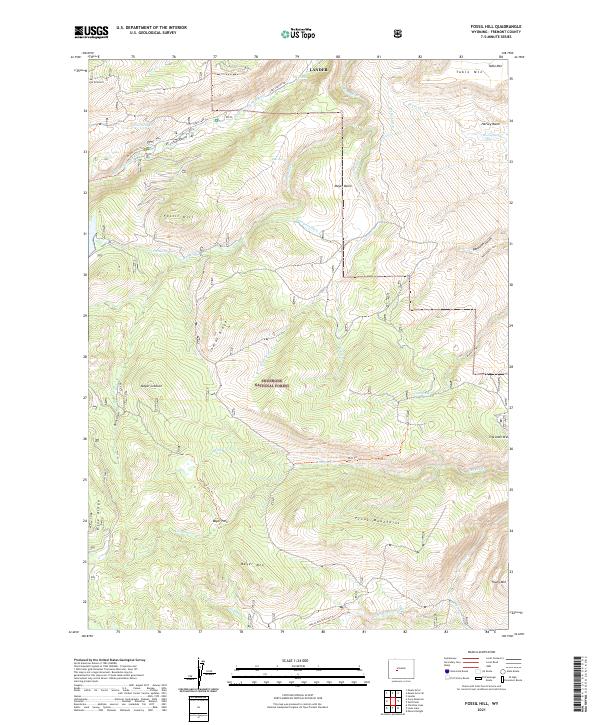
2021 Map of Fossil Hill
USGS Topo · Published 2021About this map
Shoshone National Forest lands dominate this high-elevation landscape, where the Middle Popo Agie River and Little Popo Agie River drain the eastern slopes of the Wind River Range. The terrain is defined by dramatic geological features such as the steep summit of Fossil Hill and the rugged Freak Mountains. Water management for lower-elevation agriculture is evident through the Enterprise Ditch and Walker Ditch, which redirect flow across the high basins. Recreational and fire management infrastructure appears via the Meyer Lookout and numerous backcountry routes like the Middle Fork Trail and Wolf Trail. The map also details several family-named and topographic landmarks, including Bayer Mountain, Table Mountain, and the deep incision of Sinks Canyon where the river enters its namesake underground passage.
Find a feature on this map
45 named features on this map. Tap any name to fly to it.
Don’t see what you’re looking for? This feature index may not catch every label — zoom into the map to look around manually.
Map Details
Editions of this 2021 Fossil Hill Map
This is the sole edition of this map. No revisions or reprints were ever made.
Other maps of this area

1952 · Lander
USGS Topo · 1:24,000

1953 · Cony Mountain
USGS Topo · 1:24,000

1953 · Mount Arter
USGS Topo · 1:24,000

1953 · Fossil Hill
USGS Topo · 1:24,000

1953 · Louis Lake
USGS Topo · 1:24,000

1953 · Christina Lake
USGS Topo · 1:24,000

1953 · Mount Arter SE
USGS Topo · 1:24,000

1954 · Wolf Point
USGS Topo · 1:24,000

1954 · Miners Delight
USGS Topo · 1:24,000

1955 · Lander
USGS Topo · 1:250,000