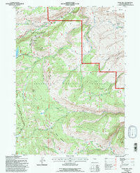
1991 Map of Fossil Hill
USGS Topo · Published 1997About this map
Sinks Canyon State Park serves as a dramatic focal point in this Fremont County landscape, where the Middle Fork Popo Agie River disappears into a limestone cavern and re-emerges further down the canyon. The high-altitude terrain is defined by prominent peaks like Fossil Hill and the uniquely named Freak Mountains, with the Shoshone National Forest covering much of the rugged topography. Human presence is marked by specialized infrastructure, such as the University of Missouri Geology Camp, which takes advantage of the area's exposed stratigraphic layers.
Find a feature on this map
37 named features on this map. Tap any name to fly to it.
Don’t see what you’re looking for? This feature index may not catch every label — zoom into the map to look around manually.
Map Details
Editions of this 1991 Fossil Hill Map
This is the sole edition of this map. No revisions or reprints were ever made.
Other maps of this area

1952 · Lander
USGS Topo · 1:24,000

1953 · Cony Mountain
USGS Topo · 1:24,000

1953 · Mount Arter
USGS Topo · 1:24,000

1953 · Fossil Hill
USGS Topo · 1:24,000

1953 · Louis Lake
USGS Topo · 1:24,000

1953 · Christina Lake
USGS Topo · 1:24,000

1953 · Mount Arter SE
USGS Topo · 1:24,000

1954 · Wolf Point
USGS Topo · 1:24,000

1954 · Miners Delight
USGS Topo · 1:24,000

1955 · Lander
USGS Topo · 1:250,000