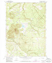
1966 Map of Foster Butte
USGS Topo · Published 1980About this map
Fremont National Forest dominates this section of southern Oregon, where the high-desert landscape is defined by its water sources and historical livestock operations. The presence of McCall Dipping Vat Spring and Sherlock Dipping Vat Spring points to a landscape historically utilized by sheep and cattle ranchers for health-related animal management. The map is bisected by the Old Indian Treaty Boundary, a significant line of demarcation that cuts across New England Flat and the foothills near Foster Butte. Water is localized in small seasonal basins such as Foster Lake, Buckaroo Lake, and Sarah Lake, while industrial activity is represented by a Cinder Pit and Quarry. The terrain shifts from the open expanses of Meadow Flat to the more varied topography of Deer Head, showing the isolated nature of these uplands in the mid-1960s.
Find a feature on this map
28 named features on this map. Tap any name to fly to it.
Don’t see what you’re looking for? This feature index may not catch every label — zoom into the map to look around manually.
Map Details
Editions of this 1966 Foster Butte Map
3 editions found

Other maps of this area

1889 · Klamath
USGS Topo · 1:250,000

1894 · Klamath
USGS Topo · 1:250,000

1955 · Crescent
USGS Topo · 1:250,000

1955 · Klamath Falls
USGS Topo · 1:250,000

1957 · Crescent
USGS Topo · 1:250,000

1958 · Crescent
USGS Topo · 1:250,000

1958 · Klamath Falls
USGS Topo · 1:250,000

1960 · Sycan Marsh
USGS Topo · 1:62,500

1966 · Summer Lake
USGS Topo · 1:24,000

1966 · Fremont Point
USGS Topo · 1:24,000