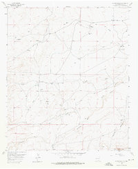
1957 Map of Foster Ranch
USGS Topo · Published 1976About this map
Foster Ranch and the surrounding high desert of Eddy County are defined by a complex network of ephemeral drainages and isolated outposts in this late 1950s survey. The landscape is carved by the Dagger Draw, Long Draw, and the multiple forks of the Seven Rivers system, including Middle Seven Rivers and South Seven Rivers. Human presence is marked by scattered homesteads and water sources critical for ranching, such as Knowles Place, Lee Ranch, and the Rock House.
Find a feature on this map
34 named features on this map. Tap any name to fly to it.
Don’t see what you’re looking for? This feature index may not catch every label — zoom into the map to look around manually.
Map Details
Editions of this 1957 Foster Ranch Map
2 editions found
Other maps of this area

1940 · Bandanna Point
USGS Topo · 1:62,500

1943 · Bandanna Point
USGS Topo · 1:62,500

1943 · West Carlsbad
USGS Topo · 1:62,500

1945 · West Carlsbad
USGS Topo · 1:62,500

1954 · Seven Rivers
USGS Topo · 1:24,000

1954 · Carlsbad
USGS Topo · 1:250,000

1955 · Dayton
USGS Topo · 1:24,000

1956 · Parish Ranch
USGS Topo · 1:24,000

1956 · Antelope Sink
USGS Topo · 1:24,000

1957 · Foster Ranch
USGS Topo · 1:24,000