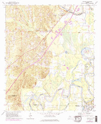
1969 Map of Fosters
USGS Topo · Published 1978About this map
The Black Warrior River dominates this 1960s landscape, carving massive loops like Toxy Bend and Hemphill Bend through the Alabama lowlands. The southern reach of the map features the significant State Monument at Moundville, where a museum and picnic area sit adjacent to ancient Indian Mounds and a Mound. This area serves as a focal point for both archaeological history and modern recreation, evidenced by the nearby Boat Ramp on the riverbank.
Find a feature on this map
41 named features on this map. Tap any name to fly to it.
Don’t see what you’re looking for? This feature index may not catch every label — zoom into the map to look around manually.
Map Details
Editions of this 1969 Fosters Map
2 editions found
Other maps of this area

1924 · Tuscaloosa
USGS Topo · 1:62,500

1926 · Tuscaloosa
USGS Topo · 1:62,500

1927 · Eutaw
USGS Topo · 1:48,000

1931 · Eutaw
USGS Topo · 1:62,500

1953 · Montgomery
USGS Topo · 1:250,000

1953 · Birmingham
USGS Topo · 1:250,000

1956 · Birmingham
USGS Topo · 1:250,000

1956 · Montgomery
USGS Topo · 1:250,000

1957 · Birmingham
USGS Topo · 1:250,000

1957 · Montgomery
USGS Topo · 1:250,000