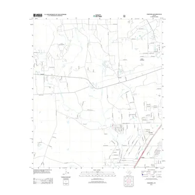
2013 Map of Fostoria
USGS Topo · Published 2013About this map
Peach Cr and its numerous tributaries, including Shell Br and Jayhawker Cr, define the landscape of this East Texas region in the early 21st century. The map centers on the small communities of Security and Fostoria, where the local road network intersects with established rail features like the Security Siding. The area is characterized by a mix of residential developments and natural hydrology, with several small family or community burial grounds such as Security Cem and Morgan Cem located near the watercourses.
Find a feature on this map
147 named features on this map. Tap any name to fly to it.
Don’t see what you’re looking for? This feature index may not catch every label — zoom into the map to look around manually.
Map Details
Editions of this 2013 Fostoria Map
This is the sole edition of this map. No revisions or reprints were ever made.
Other maps of this area

1954 · Beaumont
USGS Topo · 1:250,000

1957 · Beaumont
USGS Topo · 1:250,000

1958 · Fostoria
USGS Topo · 1:24,000

1958 · Cleveland
USGS Topo · 1:24,000

1958 · Westcott
USGS Topo · 1:24,000

1958 · Bear Creek
USGS Topo · 1:24,000

1959 · Plum Grove
USGS Topo · 1:24,000

1959 · Outlaw Pond
USGS Topo · 1:24,000

1959 · Cut and Shoot
USGS Topo · 1:24,000

1959 · Conroe NE
USGS Topo · 1:24,000