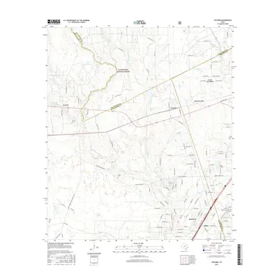
2016 Map of Fostoria
USGS Topo · Published 2016About this map
Sam Houston National Forest dominates the northwest corner of this landscape, where the headwaters of Peach Cr and Duck Cr weave through the timberlands of East Texas. The map illustrates the convergence of three counties—San Jacinto, Montgomery, and Liberty—anchored by the settlements of Fostoria and Splendora. Historically a region defined by its timber resources, the survey shows a network of rural routes like Old Hwy 105 E and Morgan Cemetery Rd connecting small community centers. Genealogists can identify several local burial sites, including Security Cem near Security and the Pin Oak Cem to the east. Water features like Chapman Ponds, Big Pond, and Horse Marsh punctuate the low-lying terrain between the growing areas of Cleveland and North Cleveland.
Find a feature on this map
130 named features on this map. Tap any name to fly to it.
Don’t see what you’re looking for? This feature index may not catch every label — zoom into the map to look around manually.
Map Details
Editions of this 2016 Fostoria Map
This is the sole edition of this map. No revisions or reprints were ever made.
Other maps of this area

1954 · Beaumont
USGS Topo · 1:250,000

1957 · Beaumont
USGS Topo · 1:250,000

1958 · Fostoria
USGS Topo · 1:24,000

1958 · Cleveland
USGS Topo · 1:24,000

1958 · Westcott
USGS Topo · 1:24,000

1958 · Bear Creek
USGS Topo · 1:24,000

1959 · Plum Grove
USGS Topo · 1:24,000

1959 · Outlaw Pond
USGS Topo · 1:24,000

1959 · Cut and Shoot
USGS Topo · 1:24,000

1959 · Conroe NE
USGS Topo · 1:24,000