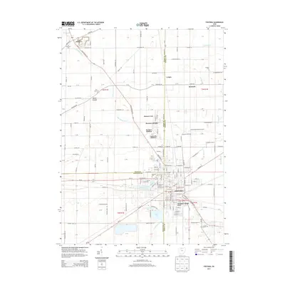
2013 Map of Fostoria
USGS Topo · Published 2013About this map
Fostoria anchors this landscape where Wood, Seneca, and Hancock counties converge, showing a well-established industrial and transit hub in the early twenty-first century. The city's residential expansions, including Westgate Village Park, Madison Addition, and Flechtner Heights, reflect modern suburban growth patterns surrounding the traditional urban core. To the north, the terrain transitions into a patchwork of rural agriculture and small settlements like West Millgrove and Longley, where older property divisions remain visible against the grid of county and township roads.
Find a feature on this map
129 named features on this map. Tap any name to fly to it.
Don’t see what you’re looking for? This feature index may not catch every label — zoom into the map to look around manually.
Map Details
Editions of this 2013 Fostoria Map
This is the sole edition of this map. No revisions or reprints were ever made.
Other maps of this area

1901 · Fostoria
USGS Topo · 1:62,500

1901 · Bowling Green
USGS Topo · 1:62,500

1901 · Elmore
USGS Topo · 1:62,500

1903 · Bowling Green
USGS Topo · 1:62,500

1903 · Fostoria
USGS Topo · 1:62,500

1903 · Findlay
USGS Topo · 1:62,500

1903 · Elmore
USGS Topo · 1:62,500

1956 · Toledo
USGS Topo · 1:250,000

1958 · Jerry City
USGS Topo · 1:24,000
1958 · Bradner
USGS Topo · 1:24,000