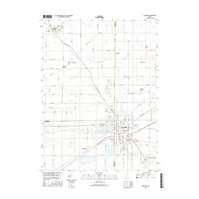
2016 Map of Fostoria
USGS Topo · Published 2016About this map
Fostoria sits at the junction of Hancock and Seneca counties, serving as a significant regional hub where rail lines and major thoroughfares converge. The landscape is defined by the hydrologic network of the E Br Portage River and S Br Muddy Cr, which flow through a largely agricultural grid punctuated by several small lakes including Lamberjack Lake and Mottram Lake. To the north, the small settlements of West Millgrove and Longley maintain their distinct identities, connected to the city by a web of township and county roads.
Find a feature on this map
144 named features on this map. Tap any name to fly to it.
Don’t see what you’re looking for? This feature index may not catch every label — zoom into the map to look around manually.
Map Details
Editions of this 2016 Fostoria Map
This is the sole edition of this map. No revisions or reprints were ever made.
Other maps of this area

1901 · Fostoria
USGS Topo · 1:62,500

1901 · Bowling Green
USGS Topo · 1:62,500

1901 · Elmore
USGS Topo · 1:62,500

1903 · Bowling Green
USGS Topo · 1:62,500

1903 · Fostoria
USGS Topo · 1:62,500

1903 · Findlay
USGS Topo · 1:62,500

1903 · Elmore
USGS Topo · 1:62,500

1956 · Toledo
USGS Topo · 1:250,000

1958 · Jerry City
USGS Topo · 1:24,000
1958 · Bradner
USGS Topo · 1:24,000