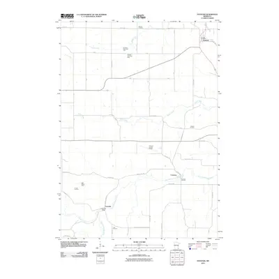
2010 Map of Fountain
USGS Topo · Published 2010About this map
Forestville and the expansive Forestville Mystery State Park define the southern landscape of this Fillmore County region. The terrain is deeply influenced by the winding path of the South Branch Root River and its tributaries, including Watson Creek and Forestville Creek. This area preserves several early settlement markers, notably the Forestville Bridge and a cluster of family and community burial grounds such as Pioneer Cemetery, Duff Cemetery, and Winslow Cemetery. In the northeast, the town of Fountain serves as a local hub near Rice Creek, while the central portion of the map is occupied by the Fillmore County Airport. The presence of several detention structures, such as the Erickson Detention Dam and Otto Meyer Dam, indicates a managed water system designed to control the drainage into the river valleys.
Find a feature on this map
39 named features on this map. Tap any name to fly to it.
Don’t see what you’re looking for? This feature index may not catch every label — zoom into the map to look around manually.
Map Details
Editions of this 2010 Fountain Map
This is the sole edition of this map. No revisions or reprints were ever made.
Other maps of this area

1954 · Chatfield
USGS Topo · 1:62,500

1954 · Mason City
USGS Topo · 1:250,000

1955 · Stewartville
USGS Topo · 1:62,500

1957 · Mason City
USGS Topo · 1:250,000

1958 · Mason City
USGS Topo · 1:250,000

1965 · Greenleafton
USGS Topo · 1:24,000

1965 · Harmony
USGS Topo · 1:24,000

1965 · Wykoff
USGS Topo · 1:24,000

1965 · Fountain
USGS Topo · 1:24,000

1965 · Cherry Grove
USGS Topo · 1:24,000