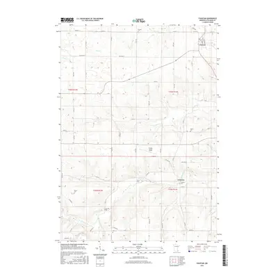
2016 Map of Fountain
USGS Topo · Published 2016About this map
The S Br Root River and its numerous tributaries, including Watson Cr and Sugar Cr, carve through the rolling agricultural landscape of Fillmore County in this 2016 survey. The settlement of Fountain stands in the northeast, while the smaller hamlets of Carimona and Forestville are positioned further south along the river valleys. This map is particularly valuable for genealogical research, as it documents several historical burial grounds such as Winslow Cem, Watson Cem, and the Pioneer Cem. The presence of the Fillmore County Airport and a grid of rural roads like Mulligan Rd and Co Hwy 11 reflects the modern infrastructure supporting the region's farming economy. From the banks of Forestville Cr to the heights near Curtis Cr, the map illustrates a landscape defined by its waterways and small, enduring rural centers.
Find a feature on this map
63 named features on this map. Tap any name to fly to it.
Don’t see what you’re looking for? This feature index may not catch every label — zoom into the map to look around manually.
Map Details
Editions of this 2016 Fountain Map
This is the sole edition of this map. No revisions or reprints were ever made.
Other maps of this area

1954 · Chatfield
USGS Topo · 1:62,500

1954 · Mason City
USGS Topo · 1:250,000

1955 · Stewartville
USGS Topo · 1:62,500

1957 · Mason City
USGS Topo · 1:250,000

1958 · Mason City
USGS Topo · 1:250,000

1965 · Greenleafton
USGS Topo · 1:24,000

1965 · Harmony
USGS Topo · 1:24,000

1965 · Wykoff
USGS Topo · 1:24,000

1965 · Fountain
USGS Topo · 1:24,000

1965 · Cherry Grove
USGS Topo · 1:24,000