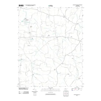
2010 Map of Fountain Head
USGS Topo · Published 2010About this map
Buck Lodge and the surrounding rural landscapes of Sumner County are meticulously documented in this 2010 study. The area is defined by a dense network of country roads and family-named landmarks, reflecting a community deeply rooted in its local geography. Significant water features including Portland City Lake and the Sumner Sportsman Club Lake are shown alongside their respective dams, marking the transition from natural drainage to managed water resources for the nearby population centers.
Find a feature on this map
90 named features on this map. Tap any name to fly to it.
Don’t see what you’re looking for? This feature index may not catch every label — zoom into the map to look around manually.
Map Details
Editions of this 2010 Fountain Head Map
This is the sole edition of this map. No revisions or reprints were ever made.
Other maps of this area

1903 · Nashville
USGS Topo · 1:125,000

1928 · Adolphus
USGS Topo · 1:48,000

1931 · Adolphus
USGS Topo · 1:62,500

1942 · Gallatin
USGS Topo · 1:100,000

1951 · Franklin
USGS Topo · 1:24,000

1953 · Cottontown
USGS Topo · 1:24,000
1954 · Hickory Flat
USGS Topo · 1:24,000

1954 · Adolphus
USGS Topo · 1:24,000

1955 · Bethpage
USGS Topo · 1:24,000

1955 · Gallatin
USGS Topo · 1:24,000