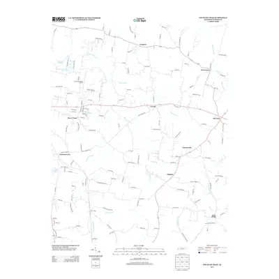
2013 Map of Fountain Head
USGS Topo · Published 2013About this map
The CSX Transportation railroad corridor anchors the western edge of this landscape, passing through the settlement of Fountain Head as it travels through northern Tennessee. The region is defined by a dense network of small communities and rural family outposts such as Sengtown, Brackentown, and Sulphura. The drainage patterns of W Fork Drakes Cr and Caney Fork Cr carve through the terrain, punctuated by local water bodies like Portland City Lake and Larry Collins Lake.
Find a feature on this map
130 named features on this map. Tap any name to fly to it.
Don’t see what you’re looking for? This feature index may not catch every label — zoom into the map to look around manually.
Map Details
Editions of this 2013 Fountain Head Map
This is the sole edition of this map. No revisions or reprints were ever made.
Other maps of this area

1903 · Nashville
USGS Topo · 1:125,000

1928 · Adolphus
USGS Topo · 1:48,000

1931 · Adolphus
USGS Topo · 1:62,500

1942 · Gallatin
USGS Topo · 1:100,000

1951 · Franklin
USGS Topo · 1:24,000

1953 · Cottontown
USGS Topo · 1:24,000
1954 · Hickory Flat
USGS Topo · 1:24,000

1954 · Adolphus
USGS Topo · 1:24,000

1955 · Bethpage
USGS Topo · 1:24,000

1955 · Gallatin
USGS Topo · 1:24,000