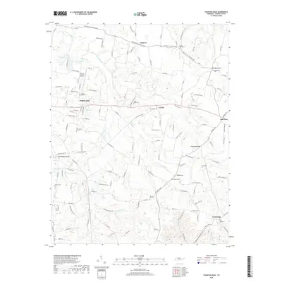
2019 Map of Fountain Head
USGS Topo · Published 2019About this map
The northern Sumner County landscape near Portland is defined by a dense network of country cemeteries and crossroads communities that speak to deep-rooted family ties. Scattered across the hills are numerous burial sites including Old Fountain Head Cem, Parkers Chapel Cem, and Brackentown Cem, reflecting the early settlement patterns of the region. The terrain is carved by the West Fork Drakes Creek and the Caney Fork Cr, with the latter creating a distinct drainage basin near Chestnut Hill.
Find a feature on this map
134 named features on this map. Tap any name to fly to it.
Don’t see what you’re looking for? This feature index may not catch every label — zoom into the map to look around manually.
Map Details
Editions of this 2019 Fountain Head Map
This is the sole edition of this map. No revisions or reprints were ever made.
Other maps of this area

1903 · Nashville
USGS Topo · 1:125,000

1928 · Adolphus
USGS Topo · 1:48,000

1931 · Adolphus
USGS Topo · 1:62,500

1942 · Gallatin
USGS Topo · 1:100,000

1951 · Franklin
USGS Topo · 1:24,000

1953 · Cottontown
USGS Topo · 1:24,000
1954 · Hickory Flat
USGS Topo · 1:24,000

1954 · Adolphus
USGS Topo · 1:24,000

1955 · Bethpage
USGS Topo · 1:24,000

1955 · Gallatin
USGS Topo · 1:24,000