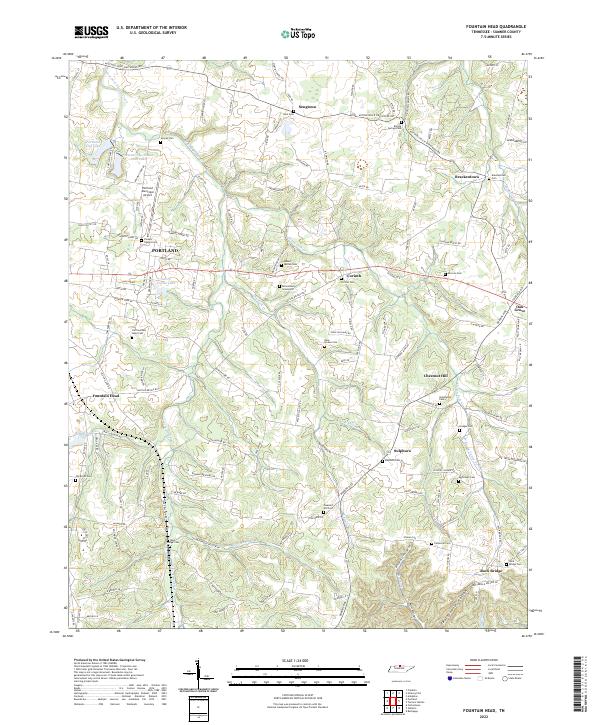
2022 Map of Fountain Head
USGS Topo · Published 2022About this map
Portland serves as the primary hub of this northern Tennessee landscape, where the Portland Municipal Airport and Portland City Lake highlight modern infrastructure alongside deep-rooted rural settlements. The terrain is characterized by the branching drainages of West Fork Drakes Creek and Caney Fork Cr, creating a series of ridges and hollows such as Wattwood Hollow and Buttermilk Hollow.
Find a feature on this map
143 named features on this map. Tap any name to fly to it.
Don’t see what you’re looking for? This feature index may not catch every label — zoom into the map to look around manually.
Map Details
Editions of this 2022 Fountain Head Map
This is the sole edition of this map. No revisions or reprints were ever made.
Other maps of this area

1903 · Nashville
USGS Topo · 1:125,000

1928 · Adolphus
USGS Topo · 1:48,000

1931 · Adolphus
USGS Topo · 1:62,500

1942 · Gallatin
USGS Topo · 1:100,000

1951 · Franklin
USGS Topo · 1:24,000

1953 · Cottontown
USGS Topo · 1:24,000
1954 · Hickory Flat
USGS Topo · 1:24,000

1954 · Adolphus
USGS Topo · 1:24,000

1955 · Bethpage
USGS Topo · 1:24,000

1955 · Gallatin
USGS Topo · 1:24,000