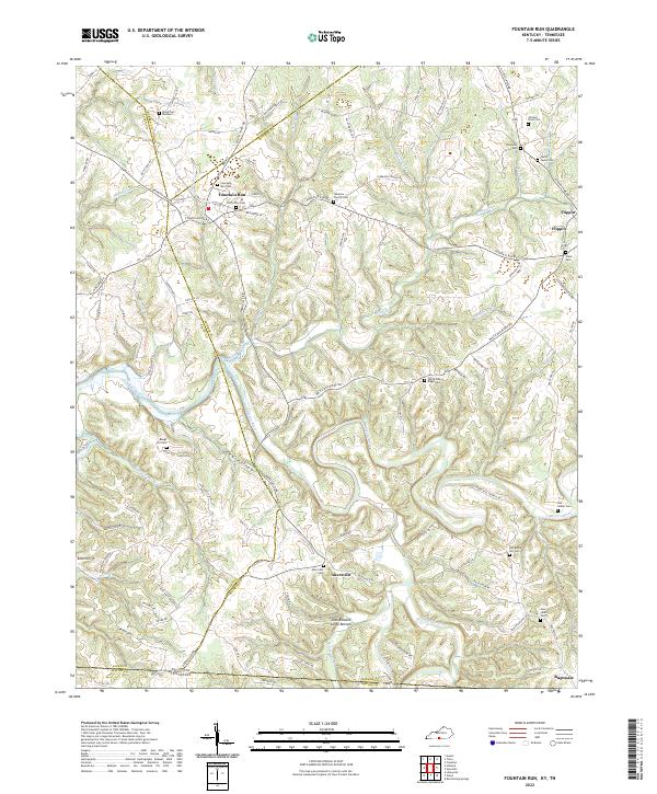
2022 Map of Fountain Run
USGS Topo · Published 2022About this map
The Barren River meanders through this borderland region where Allen, Barren, and Monroe counties meet, creating a landscape defined by deep hollows and narrow ridges. The town of Fountain Run serves as a primary settlement, with local history anchored at the Old School Cem and Fountain Run Cem. Further south, the community of Akersville sits near the Kentucky-Tennessee line, while Bugtussle occupies the southeastern corner of the quadrangle.
Find a feature on this map
107 named features on this map. Tap any name to fly to it.
Don’t see what you’re looking for? This feature index may not catch every label — zoom into the map to look around manually.
Map Details
Editions of this 2022 Fountain Run Map
This is the sole edition of this map. No revisions or reprints were ever made.
Other maps of this area

1926 · Scottsville
USGS Topo · 1:62,500

1931 · Lafayette
USGS Topo · 1:62,500

1931 · Red Boiling Springs
USGS Topo · 1:62,500

1953 · Tracy
USGS Topo · 1:24,000

1953 · Freedom
USGS Topo · 1:24,000

1954 · Austin
USGS Topo · 1:24,000

1954 · Fountain Run
USGS Topo · 1:24,000

1954 · Gamaliel
USGS Topo · 1:24,000

1954 · Holland
USGS Topo · 1:24,000

1956 · Corbin
USGS Topo · 1:250,000