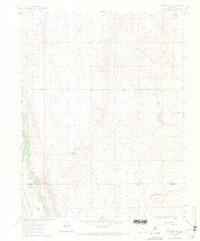
1961 Map of Fountain SE
USGS Topo · Published 1970About this map
Family ranchlands and early water management define this landscape at the border of El Paso and Pueblo Counties. Large holdings such as Hammer Ranch and Williams Ranch are interspersed among the drainages of Williams Creek and Chico Creek, reflecting the importance of grazing and water access in the mid-20th century. Infrastructure for irrigation is prominent, including the Hanover Ditch and Jackson and Burke Ditch, which cut across the high plains terrain to support local agriculture.
Find a feature on this map
14 named features on this map. Tap any name to fly to it.
Don’t see what you’re looking for? This feature index may not catch every label — zoom into the map to look around manually.
Map Details
Editions of this 1961 Fountain SE Map
4 editions found
Other maps of this area

1891 · Pueblo
USGS Topo · 1:125,000

1891 · Nepesta
USGS Topo · 1:125,000

1893 · Nepesta
USGS Topo · 1:125,000

1893 · Big Springs
USGS Topo · 1:125,000

1893 · Colorado Springs
USGS Topo · 1:125,000

1894 · Pueblo
USGS Topo · 1:125,000

1896 · Pueblo
USGS Topo · 1:125,000

1897 · Pueblo
USGS Topo · 1:125,000

1904 · Nepesta
USGS Topo · 1:125,000

1909 · Colorado Springs
USGS Topo · 1:125,000