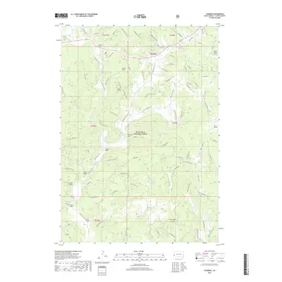
2017 Map of Fourmile
USGS Topo · Published 2017About this map
Black Hills National Forest land dominates this section of Custer County, where the high-altitude landscape is defined by deep draws and steep canyons. The settlement of Fourmile serves as a central point in the north, while the scattered homes of Pleasant Valley lie to the southwest. This era of land management is characterized by a dense network of Forest Service access roads, such as Harry Mills Rd and Pleasant Valley Rd, which facilitate movement through the complex topography of Warren Gulch and Griffis Canyon.
Find a feature on this map
84 named features on this map. Tap any name to fly to it.
Don’t see what you’re looking for? This feature index may not catch every label — zoom into the map to look around manually.
Map Details
Editions of this 2017 Fourmile Map
This is the sole edition of this map. No revisions or reprints were ever made.
Other maps of this area

1896 · Harney Peak
USGS Topo · 1:125,000

1901 · Harney Peak
USGS Topo · 1:125,000

1954 · Fourmile
USGS Topo · 1:24,000

1954 · Custer
USGS Topo · 1:24,000

1954 · Berne
USGS Topo · 1:24,000

1954 · Jewel Cave SE
USGS Topo · 1:24,000

1955 · Jewel Cave
USGS Topo · 1:24,000
1955 · Argyle
USGS Topo · 1:24,000

1955 · Signal Hill
USGS Topo · 1:24,000
1955 · Cicero Peak
USGS Topo · 1:24,000