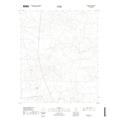
2019 Map of Fourmile Hill
USGS Topo · Published 2019About this map
Middle Fork Wichita River and the S Wichita River define the drainage of this sparsely populated cattle country in north-central Texas. The topography is dominated by the prominent Fourmile Hill, which rises above a landscape marked by winding intermittent streams like Willow Cr. A significant landmark of regional aviation and ranching heritage, the 6666 Ranch Airport serves as a modern waypoint in a region traditionally defined by large-scale landholdings. The road network is strictly functional, anchored by North-South Us-83 and local routes like Co RD 117 and Highway 82, which connect the remote divides between the river forks. This survey provides a clear look at the vast, open acreage that continues to characterize the Texas Rolling Plains.
Find a feature on this map
9 named features on this map. Tap any name to fly to it.
Don’t see what you’re looking for? This feature index may not catch every label — zoom into the map to look around manually.
Map Details
Editions of this 2019 Fourmile Hill Map
This is the sole edition of this map. No revisions or reprints were ever made.
Other maps of this area

1954 · Lubbock
USGS Topo · 1:250,000

1966 · Chalk SW
USGS Topo · 1:24,000

1966 · J Y Ranch
USGS Topo · 1:24,000

1967 · Guthrie NW
USGS Topo · 1:24,000

1967 · Dark Canyon
USGS Topo · 1:24,000

1967 · Fourmile Hill
USGS Topo · 1:24,000

1968 · Grow
USGS Topo · 1:24,000

1968 · Buffalo Creek
USGS Topo · 1:24,000

1968 · Guthrie
USGS Topo · 1:24,000

1968 · Pitchfork Flats
USGS Topo · 1:24,000