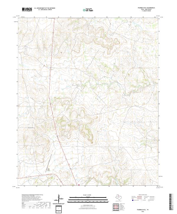
2022 Map of Fourmile Hill
USGS Topo · Published 2022About this map
Fourmile Hill stands as a prominent topographical feature in this sparsely populated region of King County, where the landscape is defined by the drainage patterns of the Middle Fork Wichita River and the S Wichita River. This 2022 survey illustrates a section of the Texas ranching country where large-scale landholdings dictate the map's character. The presence of the 6666 Ranch Airport in the southern portion of the sheet reflects the logistical realities of managing vast, remote cattle operations such as the famous 6666 Ranch.
Find a feature on this map
6 named features on this map. Tap any name to fly to it.
Don’t see what you’re looking for? This feature index may not catch every label — zoom into the map to look around manually.
Map Details
Editions of this 2022 Fourmile Hill Map
This is the sole edition of this map. No revisions or reprints were ever made.
Other maps of this area

1954 · Lubbock
USGS Topo · 1:250,000

1966 · Chalk SW
USGS Topo · 1:24,000

1966 · J Y Ranch
USGS Topo · 1:24,000

1967 · Guthrie NW
USGS Topo · 1:24,000

1967 · Dark Canyon
USGS Topo · 1:24,000

1967 · Fourmile Hill
USGS Topo · 1:24,000

1968 · Grow
USGS Topo · 1:24,000

1968 · Buffalo Creek
USGS Topo · 1:24,000

1968 · Guthrie
USGS Topo · 1:24,000

1968 · Pitchfork Flats
USGS Topo · 1:24,000