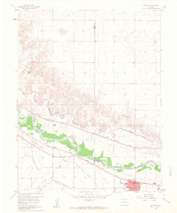
1960 Map of Fowler
USGS Topo · Published 1961About this map
The Arkansas River valley defines the character of this landscape at the intersection of Otero, Crowley, and Pueblo counties. The town of Fowler serves as a primary hub, complete with its Jr High Sch, Cem, and a local Sewage Disposal facility. The economy is visibly tied to the water and rail networks, with the Atchison Topeka and Santa Fe railroad paralleling the river. This era shows an intensive irrigation system supporting the high plains agriculture, including the Colorado Missouri Pacific Canal, the Rocky Ford Highline Canal, and the Oxford Farmers Ditch. Smaller rail-side locations like Pultney and Hamlet mark the stops between larger centers, while the landscape is punctuated by numerous Gravel Pits and drainages like Chicosa Creek and Hungerford Hollow.
Find a feature on this map
23 named features on this map. Tap any name to fly to it.
Don’t see what you’re looking for? This feature index may not catch every label — zoom into the map to look around manually.
Map Details
Editions of this 1960 Fowler Map
3 editions found
Other maps of this area

1891 · Catlin
USGS Topo · 1:125,000

1891 · Nepesta
USGS Topo · 1:125,000

1893 · Nepesta
USGS Topo · 1:125,000

1893 · Catlin
USGS Topo · 1:125,000

1904 · Nepesta
USGS Topo · 1:125,000

1954 · Olney Springs
USGS Topo · 1:24,000

1954 · Elder
USGS Topo · 1:24,000

1954 · Lamar
USGS Topo · 1:250,000

1954 · Pueblo
USGS Topo · 1:250,000

1957 · Pueblo
USGS Topo · 1:250,000