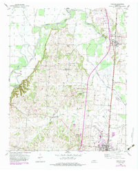
1952 Map of Fowlkes
USGS Topo · Published 1984About this map
The Forked Deer River meanders across this West Tennessee landscape, defining the boundary between Dyer Co and Lauderdale Co. This 1950s survey, updated with late 20th-century cultural features, reveals a region deeply rooted in agricultural and ecclesiastical life. Small communities and rural crossroads such as Fowlkes, Double Bridges, and Nankippo anchor the map, while numerous country houses of worship including Mt Zion Ch, Williams Chapel, and Antioch Ch dot the rolling terrain.
Find a feature on this map
37 named features on this map. Tap any name to fly to it.
Don’t see what you’re looking for? This feature index may not catch every label — zoom into the map to look around manually.
Map Details
Editions of this 1952 Fowlkes Map
2 editions found

Other maps of this area

1939 · Dyersburg
USGS Topo · 1:62,500

1939 · Hales Point
USGS Topo · 1:62,500

1939 · Caruthersville
USGS Topo · 1:62,500

1939 · Halls
USGS Topo · 1:62,500

1951 · Caruthersville
USGS Topo · 1:62,500

1952 · Hales Point
USGS Topo · 1:62,500

1952 · Gates
USGS Topo · 1:24,000

1952 · Bonicord
USGS Topo · 1:24,000

1952 · Newbern
USGS Topo · 1:24,000

1952 · Dyersburg
USGS Topo · 1:24,000