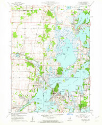
1960 Map of Fox Lake
USGS Topo · Published 1962About this map
The Chain O'Lakes State Park and surrounding water bodies dominate this mid-century landscape, illustrating a region defined by its glacial lakes and recreation. The geography of the Chain O’Lakes is rendered in significant detail, showing complex shorelines and islands from Lake Catherine in the north down to the wide expanse of Pistakee Lake. Residential growth is evident in settlements like Pistakee Highlands, Lotus Woods, and Ingleside Shore, where modern neighborhoods interface with the wetland margins.
Find a feature on this map
81 named features on this map. Tap any name to fly to it.
Don’t see what you’re looking for? This feature index may not catch every label — zoom into the map to look around manually.
Map Details
Editions of this 1960 Fox Lake Map
3 editions found
Other maps of this area

1893 · Silver Lake
USGS Topo · 1:62,500

1893 · Geneva
USGS Topo · 1:62,500

1904 · Lake Geneva
USGS Topo · 1:62,500

1906 · Silver Lake
USGS Topo · 1:62,500

1906 · Lake Geneva
USGS Topo · 1:62,500

1920 · Grays Lake
USGS Topo · 1:62,500

1923 · Grays Lake
USGS Topo · 1:62,500

1926 · Mc Henry
USGS Topo · 1:62,500

1944 · McHenry
USGS Topo · 1:62,500

1954 · Rockford
USGS Topo · 1:250,000