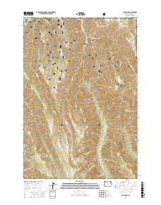
2017 Map of Fox Point
USGS Topo · Published 2017About this map
The high ridges and deep drainages of the Wallowa National Forest define this landscape in the northeastern corner of Oregon. Centered on the namesake Fox Point, the topography is carved by numerous watercourses including Bear Cr, Deer Cr, and Horse Basin Cr. Local water sources are vital to this wilderness area, marked by several remote springs such as Bearwallow Spring, Goat Mountain Spring, and Standley Spring. The terrain transitions from the high peaks of Goat Mtn and Huckleberry Mtn down into the expansive Big Canyon and Womack Basin.
Find a feature on this map
37 named features on this map. Tap any name to fly to it.
Don’t see what you’re looking for? This feature index may not catch every label — zoom into the map to look around manually.
Map Details
Editions of this 2017 Fox Point Map
This is the sole edition of this map. No revisions or reprints were ever made.
Other maps of this area

1906 · Telocaset
USGS Topo · 1:125,000

1955 · Grangeville
USGS Topo · 1:250,000

1957 · Enterprise
USGS Topo · 1:62,500

1957 · Sled Springs
USGS Topo · 1:62,500

1959 · Grangeville
USGS Topo · 1:250,000

1964 · Wallowa
USGS Topo · 1:24,000

1964 · Minam
USGS Topo · 1:24,000

1965 · Fox Point
USGS Topo · 1:24,000
1965 · Mount Moriah
USGS Topo · 1:24,000
1965 · Mt. Fanny
USGS Topo · 1:24,000