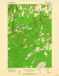
1954 Map of Foxboro
USGS Topo · Published 1960About this map
The Minnesota and Wisconsin state line bisects this 1954 landscape, where the town of Foxboro sits as a primary rail junction in the northern reaches. The area is defined by a dense network of transit history, including the Great Northern and the Sault Ste Marie and South Shore railroads. Further south, the settlement of Harlis anchors a more remote territory near the Carlton and Pine County boundary. Much of the western terrain is occupied by the Nemadji State Forest, a region of wetlands and winding waterways like the Net River and Little Net River. An Old Railroad Grade and several Gravel Pits suggest the industrial activity supporting local infrastructure. The presence of Summit Cem near the eastern border provides a significant landmark for those tracing family history in this borderland between Douglas and Carlton counties.
Find a feature on this map
25 named features on this map. Tap any name to fly to it.
Don’t see what you’re looking for? This feature index may not catch every label — zoom into the map to look around manually.
Map Details
Editions of this 1954 Foxboro Map
4 editions found
Other maps of this area

1915 · Superior
USGS Topo · 1:48,000

1917 · Superior
USGS Topo · 1:62,500

1949 · Holyoke
USGS Topo · 1:48,000

1949 · Patzau
USGS Topo · 1:48,000

1953 · Duluth
USGS Topo · 1:250,000

1954 · Borea
USGS Topo · 1:24,000

1954 · Foxboro
USGS Topo · 1:24,000

1954 · Wrenshall
USGS Topo · 1:24,000

1954 · Frogner
USGS Topo · 1:24,000
1954 · Patzau
USGS Topo · 1:24,000