Loading...
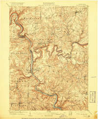
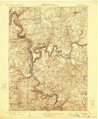
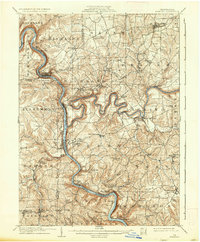
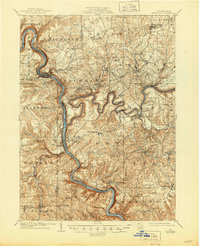
Loading map...1908 Map of Foxburg
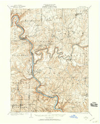
USGS Topo · Published 1917About this map
The Allegheny River and Clarion River carve deep, winding channels through this segment of Western Pennsylvania, defining the industrial and social boundaries of the early twentieth century. This survey highlights the complex intersection of river transport and rail, with the Baltimore and Ohio and Pennsylvania railroads following the narrow river benches to serve coal and iron interests. Evidence of the region’s extractive history is visible in the Blue Goose Mine and Eagle Mine, as well as the naming of the Canoe Furnace settlement.
Find a feature on this map
83 named features on this map. Tap any name to fly to it.
Don’t see what you’re looking for? This feature index may not catch every label — zoom into the map to look around manually.
Map Details
Date Portrayed1908
Date Published1917
PublisherU.S. Geological Survey
Map TypeTopographic
Scale1:62,500
Physical Dimensions16.5 x 20 inches
Editions of this 1908 Foxburg Map
5 editions found

Historical Maps of Monroe Through Time
Featured Locations
Source Details
SourceU.S. Geological Survey
CopyrightPublic Domain