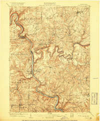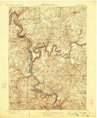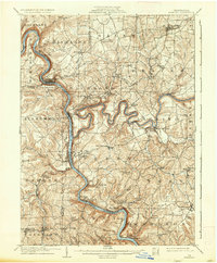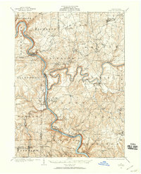
1908 Map of Foxburg
USGS Topo · Published 1944About this map
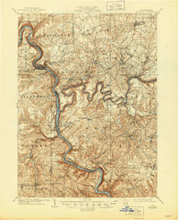
The Allegheny River carves a deep, winding path through the heart of this landscape, meeting its confluence with the Clarion River near the railroad junction at Foxburg. This era of industrial extraction is clearly visible in the terrain, marked by the presence of the Blue Goose Mine and Eagle Mine alongside iron-working history at the Saint Charles Furnace and Canoe Furnace. Transportation networks are dominated by the Baltimore and Ohio and Pennsylvania railroads, which track the riverbanks to serve river-valley settlements like Parkers City and Emlenton. Away from the water, the plateau is dotted with post offices and hamlets such as Edenburg Knox PO, West Freedom, and Callensburg, reflecting a rural economy of small-scale milling found at Stovers Mill and Kissingers Mill.
Find a feature on this map
77 named features on this map. Tap any name to fly to it.
Don’t see what you’re looking for? This feature index may not catch every label — zoom into the map to look around manually.
Map Details
Editions of this 1908 Foxburg Map
5 editions found